Transform Satellite Images into Actionable Insights
Get real-time, AI-powered satellite image analysis for business intelligence, risk assessment, and infrastructure monitoring – all through an interactive conversational dashboard.
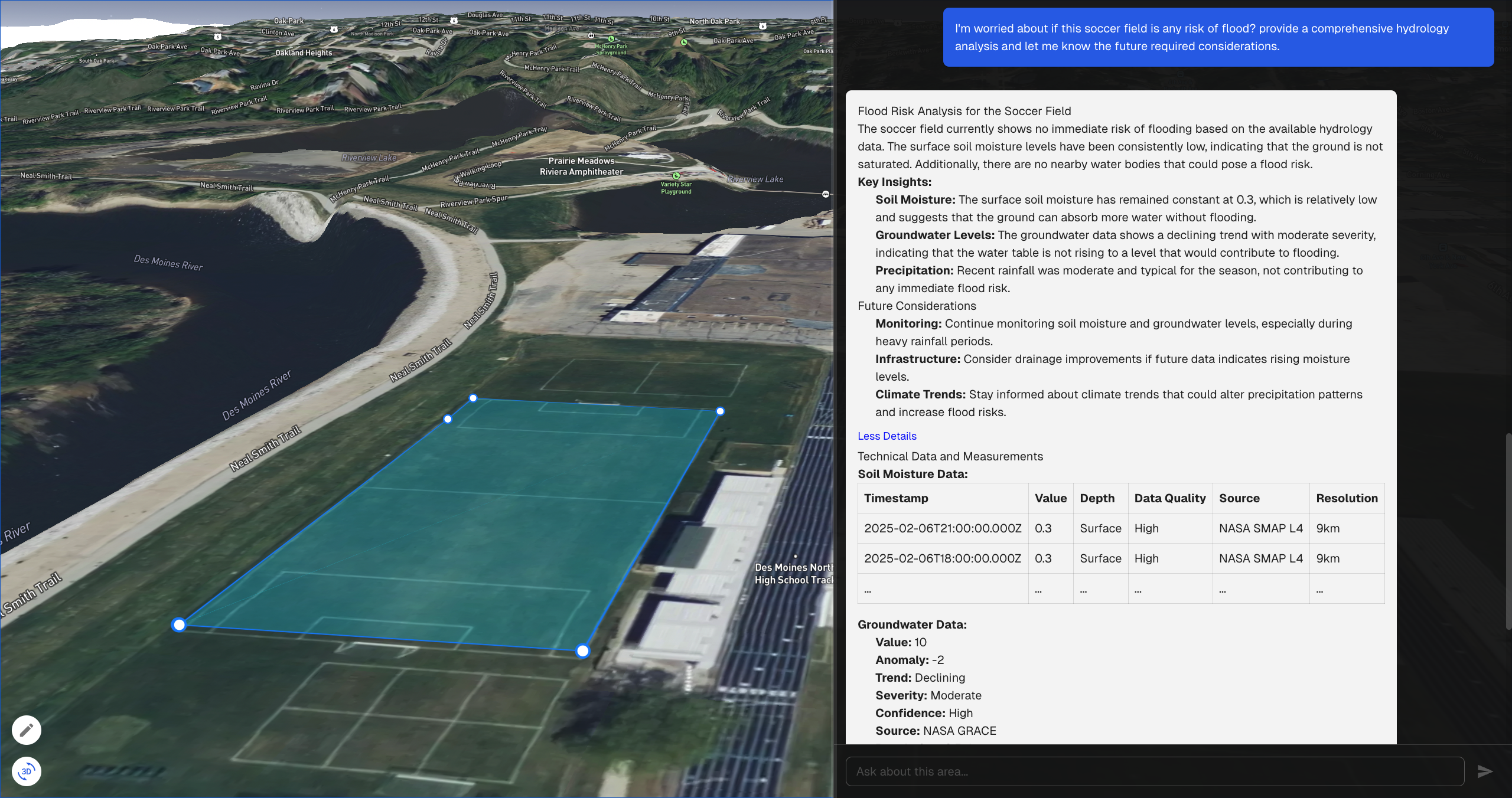
SpaceIn AI is a real-time satellite image analysis platform powered by AI. It allows users to query and analyze satellite imagery using natural language, providing actionable business intelligence across various industries.
How does SpaceIn AI process satellite images?
Our AI models analyze satellite imagery in real time and extract valuable insights, such as infrastructure changes, environmental risks, and urban growth patterns.
What industries can benefit from SpaceIn AI?
Industries such as insurance, agriculture, urban planning, defense, real estate, and environmental monitoring can leverage SpaceIn AI for data-driven decision-making.
What kind of insights can I get from SpaceIn AI?
SpaceIn AI provides insights like urban development tracking, environmental monitoring, infrastructure changes, natural disaster assessment, and land use analysis through AI-powered satellite image processing.
How can I integrate SpaceIn AI into my workflow?
SpaceIn AI offers API access and enterprise integrations that allow you to seamlessly incorporate satellite image analysis into your existing systems and workflows.
Is SpaceIn AI available for trial?
Yes, we offer a free trial that lets you explore our satellite image analysis capabilities. After the trial, you can choose from our flexible pricing plans that suit your needs.